Content
World maps bundle is the collection of over 200 editable PowerPoint maps of continents and countries, localization and transport icons, continent statistics graphics, and infographics examples.
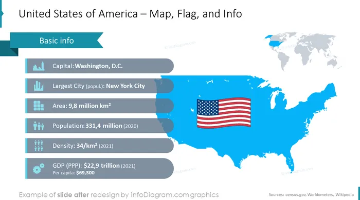
We prepared also a few maps with administrative territories covering the US States, Canada Mexico. The collections contain flags of the biggest countries: the United States of America, Canada, Brazil, China, India, The European Union, etc.
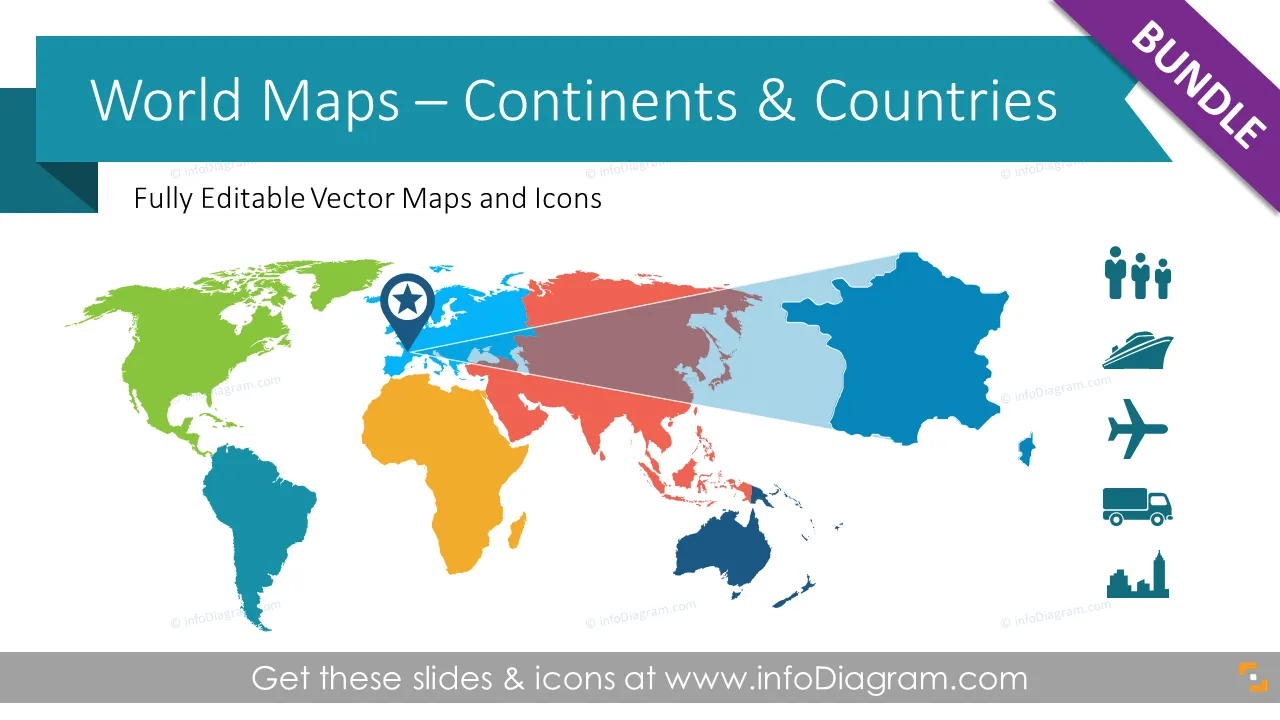
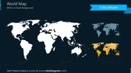
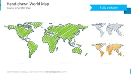
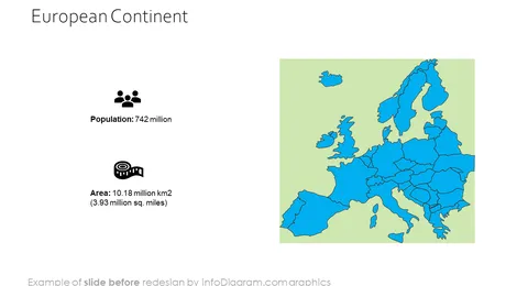
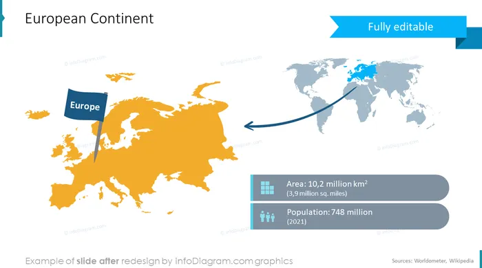
World maps collection includes the following map slides: a map of the North American continent and countries, the map of the US with states, Canadian provinces and territories, Mexican administrative territories, South America continent and countries, Europe continent and countries, Asia continent, Africa continent and countries, Australia continent, and Oceania countries.
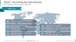
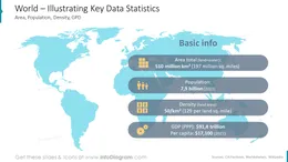
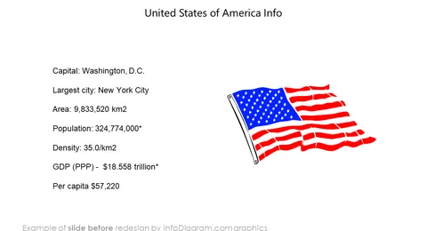
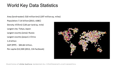
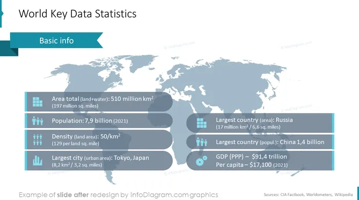
World statistics data are the next important block in our bundle. It consists of various templates to show the population, density, area, gross domestic product, and largest city in the country. These shapes can be useful for webinars, business, or education projects. Statistic data can be exported to other applications – blog, in Word, Prezi, Keynote, etc.
In the next section block of the world maps collection, you will find icons to illustrate localization and logistics on maps. We added production and distribution symbols: factory icon, production facility icon, production gear icon, distribution center icon, wholesale icon, consumption retail shop icon, etc. The world map bundle includes road, air, rail, and water transport means.
As a bonus, you will find hand-drawn arrows for showing routes from point A to point B and C creatively, visualizing transportation routes and showing flights and trains between the countries, and making a map with production and distribution centers.
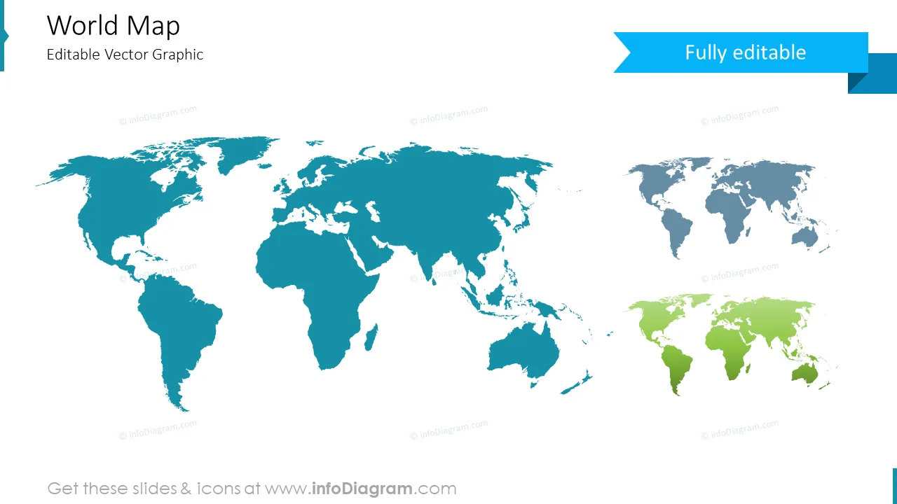
The template is fully edible, so you can adapt the colors to your brand preferences. All elements are transparent (charts, maps, flags, arrows), you can put them behind or above your content.
World maps bundle helps you to create an informative presentation. It becomes a handy assistant to international companies, which need to present their supply chain, transit, export, and import. World maps bundle is a useful assistant if you need to add a whole blank map or you want to pull out a particular part of it.
Why is it important to show geographical data visually?
Visualizing geographical data is important because it helps in understanding how things are spread out in the world. With maps and charts, it is easier to see where resources are, how populations are changing, and where things like storms or diseases might be happening. These visual tools make it easier for everyone to understand what's going on, no matter what language they speak. By using maps and other visual aids, we can work together to solve problems and make better decisions for the planet.
Further information sources on countries data
- About Continents (Wikipedia)
- About Population ( United Nations' World Population Prospects, the 2012 Revision )
- The World Factbook 2009. Washington, DC: Central Intelligence Agency ( CIA Factbook )
- Countries list by GDP ( Wikipedia )
- GDP comparisons by World Bank, International Monetary Fund, CIA World Factbook ( Wikipedia )
Acronyms used
- GDP – Gross Domestic Product
- PPP - Purchasing Power Parity
- sq mi – square mile
- km2 – square kilometer
Editable elements
Fully editable vector shapes by using built-in PowerPoint tools, including
- editing texts
- editing maps (color of the fill and outline, style - gradient, with outline, shadow, reflection)
- arrows and icon pictograms: changing fill color, size, style (gradient fill, outline, shadow, reflection)
- All elements are transparent (charts, maps, flags, arrows), you can put them behind or above your content
See the editing demonstration in our HowTo Videos.
Author