

Your graphics add a nice touch to my presentations and I recently used them for one of my all-hands meetings. Your toolbox adds professionalism to my slides. Instead of using standard clipart.
Claude Jones, Director of Engineer, @Walmartlabs, USA

Your graphics add a nice touch to my presentations and I recently used them for one of my all-hands meetings. Your toolbox adds professionalism to my slides. Instead of using standard clipart.
Claude Jones, Director of Engineer, @Walmartlabs, USA
I needed a fresh look at some of my slides. I've tried to find a way to create a paintbrush effect, to underline, accentuate, add some color and the handwritten markers were just the things. Very easy to use, easy to size, change the color. It was an affordable, perfect solution and I'm happy to recommend it.
Anonymous, US
The crisp, clean look of the graphics, and the fact that it allowed me to easily edit and change the colors to match the template was my main reason for purchasing them.
Brandie Jenkins, E-learning Developer, USA
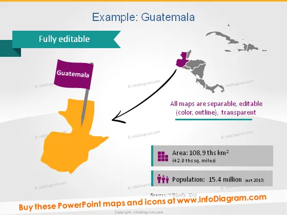
The slide presents geographical and demographic information about Guatemala. A highlighted map of Guatemala indicates its position relative to Central America. Notes on the slide state that all maps are separately editable in terms of color, outline, and transparency. There are two key statistics provided: the area of Guatemala, which is 108.9 thousand square kilometers, and the population, estimated at 15.4 million in 2013. These facts are useful for quickly understanding the country's size and populace.
The slide is visually engaging with a mix of bright and muted colors and uses icons and graphics effectively to represent data. The overall look is professional and suitable for an informative presentation.



