Your graphics add a nice touch to my presentations and I recently used them for one of my all-hands meetings. Your toolbox adds professionalism to my slides. Instead of using standard clipart.
Claude Jones, Director of Engineer, @Walmartlabs, USA
Your graphics add a nice touch to my presentations and I recently used them for one of my all-hands meetings. Your toolbox adds professionalism to my slides. Instead of using standard clipart.
Claude Jones, Director of Engineer, @Walmartlabs, USA
I needed a fresh look at some of my slides. I've tried to find a way to create a paintbrush effect, to underline, accentuate, add some color and the handwritten markers were just the things. Very easy to use, easy to size, change the color. It was an affordable, perfect solution and I'm happy to recommend it.
Anonymous, US
The crisp, clean look of the graphics, and the fact that it allowed me to easily edit and change the colors to match the template was my main reason for purchasing them.
Brandie Jenkins, E-learning Developer, USA
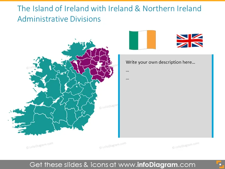
The slide presents a geographic division of the island of Ireland into two main parts, reflecting the political and administrative divisions between Ireland and Northern Ireland. It uses color-coding to distinguish the two territories and includes symbols of their respective flags. Ireland, shown in a lighter shade, covers the majority of the island, and Northern Ireland, in a darker shade, occupies a portion in the northeast.
The slide’s visual composition is clean and straightforward, enhancing the clarity of the geographic distinctions it depicts. The contrasting colors effectively signify the different political entities on the island of Ireland.


