

Your graphics add a nice touch to my presentations and I recently used them for one of my all-hands meetings. Your toolbox adds professionalism to my slides. Instead of using standard clipart.
Claude Jones, Director of Engineer, @Walmartlabs, USA

Your graphics add a nice touch to my presentations and I recently used them for one of my all-hands meetings. Your toolbox adds professionalism to my slides. Instead of using standard clipart.
Claude Jones, Director of Engineer, @Walmartlabs, USA
I needed a fresh look at some of my slides. I've tried to find a way to create a paintbrush effect, to underline, accentuate, add some color and the handwritten markers were just the things. Very easy to use, easy to size, change the color. It was an affordable, perfect solution and I'm happy to recommend it.
Anonymous, US
The crisp, clean look of the graphics, and the fact that it allowed me to easily edit and change the colors to match the template was my main reason for purchasing them.
Brandie Jenkins, E-learning Developer, USA
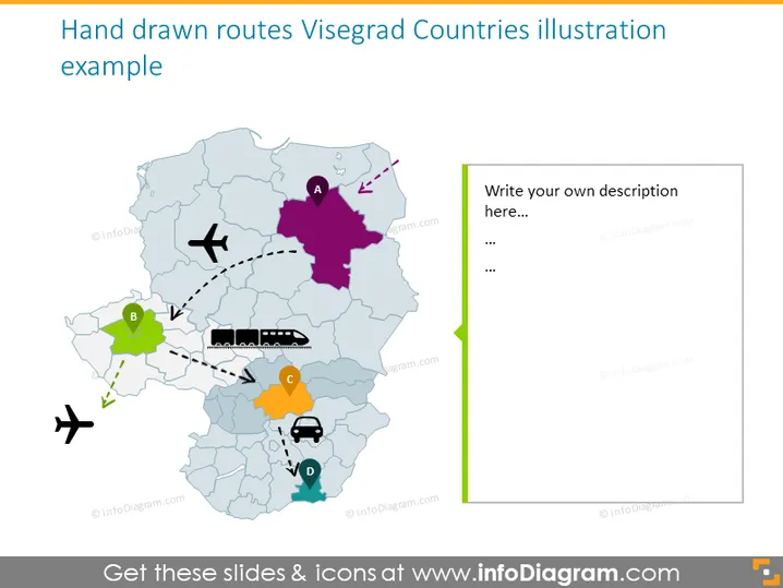
La diapositiva de PowerPoint titulada "Ilustración de Rutas Dibujadas a Mano Países de Visegrado" representa un mapa estilizado, dibujado a mano, que muestra posibles rutas y ubicaciones importantes dentro de los países de Visegrado. Cada punto etiquetado (A, B, C, D) en el mapa corresponde a un país diferente, acompañado de íconos distintivos como un avión, un tren, un coche y una fábrica para representar varios modos de transporte o puntos de interés. Las líneas punteadas indican posibles rutas que conectan estos puntos, sugiriendo caminos de viaje o conexiones logísticas.
La diapositiva tiene una estética juguetona y creativa, utilizando elementos e íconos dibujados a mano para transmitir un sentido de informalidad. La paleta de colores es suave pero lo suficientemente variada como para distinguir claramente diferentes elementos y rutas en el mapa.



