

Your graphics add a nice touch to my presentations and I recently used them for one of my all-hands meetings. Your toolbox adds professionalism to my slides. Instead of using standard clipart.
Claude Jones, Director of Engineer, @Walmartlabs, USA

Your graphics add a nice touch to my presentations and I recently used them for one of my all-hands meetings. Your toolbox adds professionalism to my slides. Instead of using standard clipart.
Claude Jones, Director of Engineer, @Walmartlabs, USA
I needed a fresh look at some of my slides. I've tried to find a way to create a paintbrush effect, to underline, accentuate, add some color and the handwritten markers were just the things. Very easy to use, easy to size, change the color. It was an affordable, perfect solution and I'm happy to recommend it.
Anonymous, US
The crisp, clean look of the graphics, and the fact that it allowed me to easily edit and change the colors to match the template was my main reason for purchasing them.
Brandie Jenkins, E-learning Developer, USA
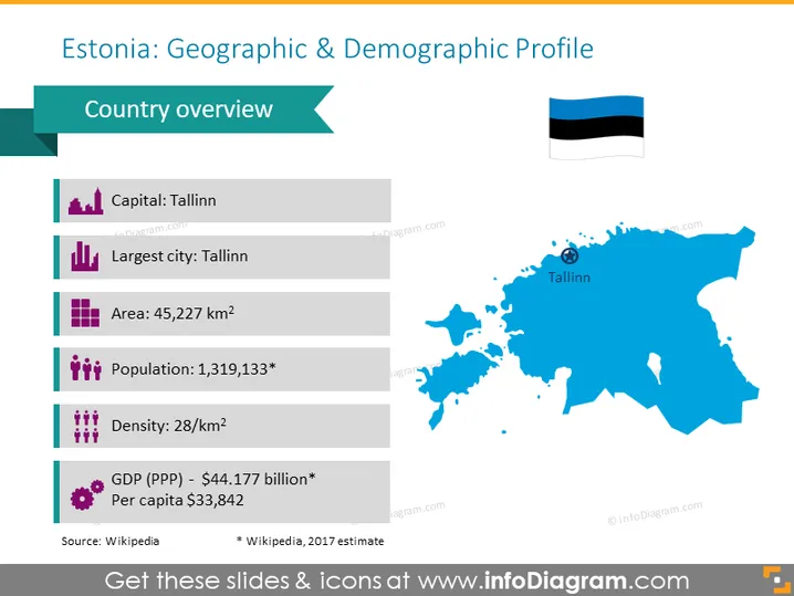
Estonia es un país plano que cubre 45,228 km² (17,463 millas cuadradas). Estonia tiene una larga y poco profunda costa (3,794 km o 2,357 millas) a lo largo del mar Báltico, con 1,520 islas salpicando la costa. Wikipedia Esta plantilla es una herramienta de visualización para tus presentaciones para hablar sobre Estonia, sus cualidades demográficas y geográficas, o cualquier otra característica que desees explicar a tu audiencia. Incluye un mapa y una tabla informativa apoyada con íconos morados.
Esta diapositiva del Mapa Demográfico y Geográfico de Estonia es parte de nuestras Plantillas de PowerPoint de Mapas de los Estados Bálticos de Europa con Territorios Administrativos.



