
Your graphics add a nice touch to my presentations and I recently used them for one of my all-hands meetings. Your toolbox adds professionalism to my slides. Instead of using standard clipart.
Claude Jones, Director of Engineer, @Walmartlabs, USA
Your graphics add a nice touch to my presentations and I recently used them for one of my all-hands meetings. Your toolbox adds professionalism to my slides. Instead of using standard clipart.
Claude Jones, Director of Engineer, @Walmartlabs, USA
I needed a fresh look at some of my slides. I've tried to find a way to create a paintbrush effect, to underline, accentuate, add some color and the handwritten markers were just the things. Very easy to use, easy to size, change the color. It was an affordable, perfect solution and I'm happy to recommend it.
Anonymous, US
The crisp, clean look of the graphics, and the fact that it allowed me to easily edit and change the colors to match the template was my main reason for purchasing them.
Brandie Jenkins, E-learning Developer, USA
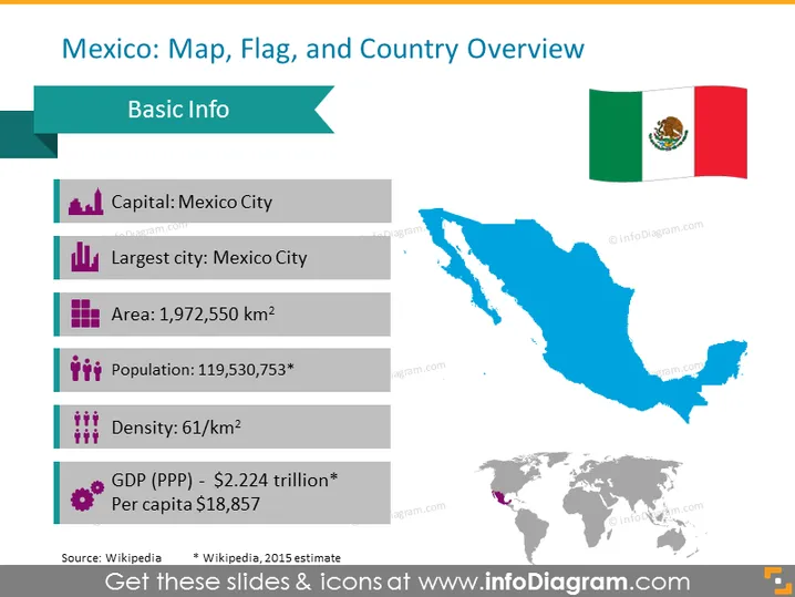
Esta diapositiva de PowerPoint está diseñada para proporcionar una visión general del país de México. La diapositiva lleva el título "México: Mapa, Bandera y Visión General del País," con una lista de datos básicos que incluye la capital, que es la Ciudad de México, que también es la ciudad más grande, un área de 1.972 millones de kilómetros cuadrados y una población de aproximadamente 119.5 millones, según una estimación de 2015. Además, se menciona que la densidad es de 61 personas por kilómetro cuadrado, y el PIB (PPA) se cita como $2.224 billones, con un ingreso per cápita de $18,857.




