

Your graphics add a nice touch to my presentations and I recently used them for one of my all-hands meetings. Your toolbox adds professionalism to my slides. Instead of using standard clipart.
Claude Jones, Director of Engineer, @Walmartlabs, USA

Your graphics add a nice touch to my presentations and I recently used them for one of my all-hands meetings. Your toolbox adds professionalism to my slides. Instead of using standard clipart.
Claude Jones, Director of Engineer, @Walmartlabs, USA
I needed a fresh look at some of my slides. I've tried to find a way to create a paintbrush effect, to underline, accentuate, add some color and the handwritten markers were just the things. Very easy to use, easy to size, change the color. It was an affordable, perfect solution and I'm happy to recommend it.
Anonymous, US
The crisp, clean look of the graphics, and the fact that it allowed me to easily edit and change the colors to match the template was my main reason for purchasing them.
Brandie Jenkins, E-learning Developer, USA
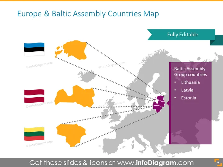
La diapositiva de PowerPoint proporciona una visión geopolítica de los países del grupo de la Asamblea Báltica y Europa, marcada con un mapa y las banderas correspondientes. La diapositiva destaca tres países miembros: Lituania, Letonia y Estonia, cada uno representado por su bandera individual y un contorno de mapa en color codificado. Lituania es conocida por su arquitectura medieval y su costa del mar Báltico. Letonia es reconocida por su cultura diversa y su capital histórica, Riga. Estonia es notable por su avanzada sociedad digital y sus pintorescos cascos antiguos.
El aspecto general es limpio y profesional, con una paleta de colores suave que ayuda a que las áreas resaltadas destaquen. El uso de banderas junto al mapa proporciona una señal visual fácil para identificar cada país.



