

Your graphics add a nice touch to my presentations and I recently used them for one of my all-hands meetings. Your toolbox adds professionalism to my slides. Instead of using standard clipart.
Claude Jones, Director of Engineer, @Walmartlabs, USA

Your graphics add a nice touch to my presentations and I recently used them for one of my all-hands meetings. Your toolbox adds professionalism to my slides. Instead of using standard clipart.
Claude Jones, Director of Engineer, @Walmartlabs, USA
I needed a fresh look at some of my slides. I've tried to find a way to create a paintbrush effect, to underline, accentuate, add some color and the handwritten markers were just the things. Very easy to use, easy to size, change the color. It was an affordable, perfect solution and I'm happy to recommend it.
Anonymous, US
The crisp, clean look of the graphics, and the fact that it allowed me to easily edit and change the colors to match the template was my main reason for purchasing them.
Brandie Jenkins, E-learning Developer, USA
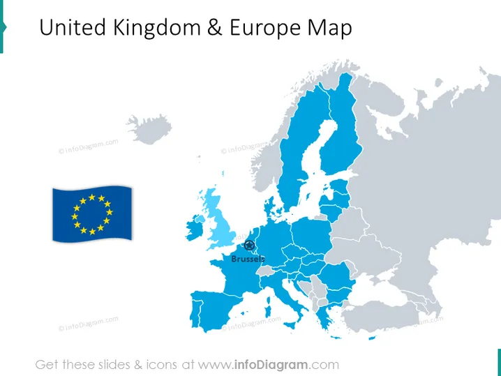
La diapositiva de PowerPoint presenta un mapa estilizado que muestra la relación entre el Reino Unido y Europa. Un gráfico flotante separado de la bandera de la Unión Europea sugiere una conexión o distinción entre el Reino Unido y el resto de Europa. El mapa podría estar haciendo referencia al paisaje geopolítico posterior al Brexit, ya que el Reino Unido está coloreado de manera diferente a los países miembros de la UE. Un marcador sobre Bruselas implica un punto específico de enfoque o importancia, posiblemente denotando el centro administrativo de la Unión Europea.
La diapositiva tiene un diseño limpio y minimalista, con un uso selectivo de colores para enfatizar diferentes regiones. Los elementos gráficos como la bandera de la UE y el ícono de Bruselas añaden información contextual a la representación geográfica.



