Your graphics add a nice touch to my presentations and I recently used them for one of my all-hands meetings. Your toolbox adds professionalism to my slides. Instead of using standard clipart.
Claude Jones, Director of Engineer, @Walmartlabs, USA
Your graphics add a nice touch to my presentations and I recently used them for one of my all-hands meetings. Your toolbox adds professionalism to my slides. Instead of using standard clipart.
Claude Jones, Director of Engineer, @Walmartlabs, USA
I needed a fresh look at some of my slides. I've tried to find a way to create a paintbrush effect, to underline, accentuate, add some color and the handwritten markers were just the things. Very easy to use, easy to size, change the color. It was an affordable, perfect solution and I'm happy to recommend it.
Anonymous, US
The crisp, clean look of the graphics, and the fact that it allowed me to easily edit and change the colors to match the template was my main reason for purchasing them.
Brandie Jenkins, E-learning Developer, USA
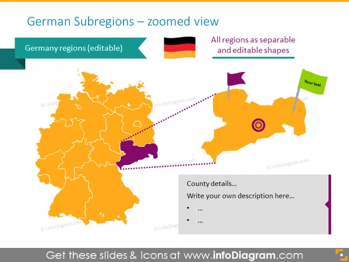
La République fédérale d'Allemagne, en tant qu'État fédéral, est composée de seize États (allemand : Länder, sing. Land). La Bavière, la Saxe et la Thuringe se décrivent comme un Freistaat ("État libre"), et Berlin et Hambourg sont souvent appelés Stadtstaaten ("villes-États"), tout comme la Ville hanséatique libre de Brême, qui comprend les villes de Brême et de Bremerhaven. Les treize autres États sont appelés Flächenländer ("États de surface").
Ce modèle PowerPoint visualise la carte de l'Allemagne avec des visuels de régions entièrement modifiables. Les régions sont colorées en orange par défaut, mais vous pouvez changer les couleurs ou redimensionner une région pour les mettre en avant.
Cette diapositive de carte des sous-régions d'Allemagne fait partie de notre carte de l'Europe occidentale avec territoires administratifs (Allemagne, France Modèles PPT modifiables).


