

Your graphics add a nice touch to my presentations and I recently used them for one of my all-hands meetings. Your toolbox adds professionalism to my slides. Instead of using standard clipart.
Claude Jones, Director of Engineer, @Walmartlabs, USA

Your graphics add a nice touch to my presentations and I recently used them for one of my all-hands meetings. Your toolbox adds professionalism to my slides. Instead of using standard clipart.
Claude Jones, Director of Engineer, @Walmartlabs, USA
I needed a fresh look at some of my slides. I've tried to find a way to create a paintbrush effect, to underline, accentuate, add some color and the handwritten markers were just the things. Very easy to use, easy to size, change the color. It was an affordable, perfect solution and I'm happy to recommend it.
Anonymous, US
The crisp, clean look of the graphics, and the fact that it allowed me to easily edit and change the colors to match the template was my main reason for purchasing them.
Brandie Jenkins, E-learning Developer, USA
Die Begriffe Baltische Meerregion, Baltische Randländer (oder einfach das Baltische Ufer) und die baltischen Länder/Staaten beziehen sich auf leicht unterschiedliche Kombinationen von Ländern im allgemeinen Gebiet rund um die Ostsee, hauptsächlich in Nordeuropa. Der Begriff "Baltische Staaten" bezieht sich speziell auf eine solche Gruppe. Wikipedia
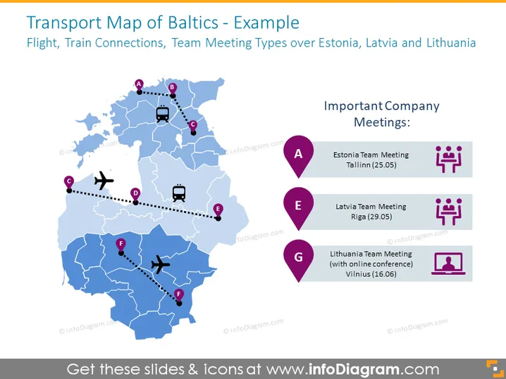
Diese PowerPoint-Vorlage visualisiert die Transportrotationen wie Flüge und Zugverbindungen über die Karte der Balten. Die Vorlage wird durch Icons und Diagramme ergänzt, um bestimmte Bereiche und Verkehrsmittel hervorzuheben.
Diese Folie zur Transportkarte der Balten ist Teil unserer PowerPoint-Vorlage für die Karten der Baltischen Staaten mit Verwaltungsgebieten.



