
Your graphics add a nice touch to my presentations and I recently used them for one of my all-hands meetings. Your toolbox adds professionalism to my slides. Instead of using standard clipart.
Claude Jones, Director of Engineer, @Walmartlabs, USA
Your graphics add a nice touch to my presentations and I recently used them for one of my all-hands meetings. Your toolbox adds professionalism to my slides. Instead of using standard clipart.
Claude Jones, Director of Engineer, @Walmartlabs, USA
I needed a fresh look at some of my slides. I've tried to find a way to create a paintbrush effect, to underline, accentuate, add some color and the handwritten markers were just the things. Very easy to use, easy to size, change the color. It was an affordable, perfect solution and I'm happy to recommend it.
Anonymous, US
The crisp, clean look of the graphics, and the fact that it allowed me to easily edit and change the colors to match the template was my main reason for purchasing them.
Brandie Jenkins, E-learning Developer, USA
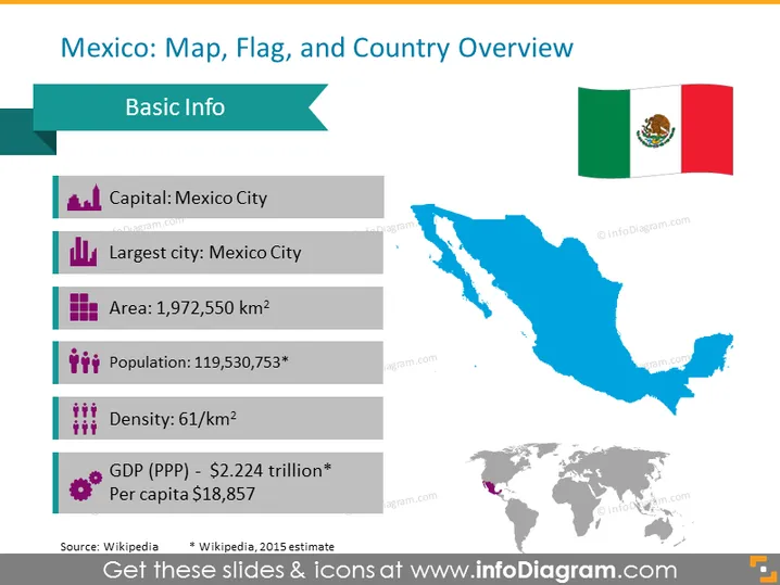
Diese PowerPoint-Folie ist darauf ausgelegt, eine Länderübersicht für Mexiko bereitzustellen. Die Folie trägt den Titel „Mexiko: Karte, Flagge und Länderübersicht“, mit einer Liste grundlegender Informationsfakten, die die Hauptstadt als Mexiko-Stadt anführt, die auch die größte Stadt ist, eine Fläche von 1,972 Millionen Quadratkilometern und eine Bevölkerung von etwa 119,5 Millionen laut einer Schätzung aus dem Jahr 2015. Darüber hinaus wird die Bevölkerungsdichte mit 61 Personen pro Quadratkilometer erwähnt, und das BIP (Kaufkraftparität) wird mit 2,224 Billionen Dollar angegeben, bei einem Pro-Kopf-Einkommen von 18.857 Dollar.




