
Your graphics add a nice touch to my presentations and I recently used them for one of my all-hands meetings. Your toolbox adds professionalism to my slides. Instead of using standard clipart.
Claude Jones, Director of Engineer, @Walmartlabs, USA
Your graphics add a nice touch to my presentations and I recently used them for one of my all-hands meetings. Your toolbox adds professionalism to my slides. Instead of using standard clipart.
Claude Jones, Director of Engineer, @Walmartlabs, USA
I needed a fresh look at some of my slides. I've tried to find a way to create a paintbrush effect, to underline, accentuate, add some color and the handwritten markers were just the things. Very easy to use, easy to size, change the color. It was an affordable, perfect solution and I'm happy to recommend it.
Anonymous, US
The crisp, clean look of the graphics, and the fact that it allowed me to easily edit and change the colors to match the template was my main reason for purchasing them.
Brandie Jenkins, E-learning Developer, USA
Die Bundesrepublik Deutschland, als Bundesstaat, besteht aus sechzehn Bundesländern (Deutsch: Länder, sing. Land). Bayern, Sachsen und Thüringen bezeichnen sich selbst als Freistaat und Berlin sowie Hamburg werden häufig als Stadtstaaten bezeichnet, ebenso wie die Freie Hansestadt Bremen, die die Städte Bremen und Bremerhaven umfasst. Die anderen dreizehn Bundesländer werden Flächenländer genannt. - Wikipedia
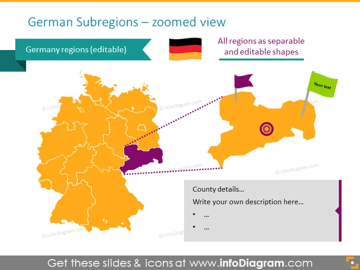
Diese PowerPoint-Vorlage visualisiert die Karte Deutschlands mit vollständig bearbeitbaren Regionsvisualisierungen. Die Regionen sind standardmäßig orange gefärbt, aber Sie können die Farben ändern oder eine beliebige Region vergrößern, um sie hervorzuheben.
Diese Folie zur Karte der Unterregionen Deutschlands ist Teil unserer Karte Westeuropas mit administrativen Territorien (Bearbeitbare Karten von Deutschland, Frankreich).




