
Your graphics add a nice touch to my presentations and I recently used them for one of my all-hands meetings. Your toolbox adds professionalism to my slides. Instead of using standard clipart.
Claude Jones, Director of Engineer, @Walmartlabs, USA
Your graphics add a nice touch to my presentations and I recently used them for one of my all-hands meetings. Your toolbox adds professionalism to my slides. Instead of using standard clipart.
Claude Jones, Director of Engineer, @Walmartlabs, USA
I needed a fresh look at some of my slides. I've tried to find a way to create a paintbrush effect, to underline, accentuate, add some color and the handwritten markers were just the things. Very easy to use, easy to size, change the color. It was an affordable, perfect solution and I'm happy to recommend it.
Anonymous, US
The crisp, clean look of the graphics, and the fact that it allowed me to easily edit and change the colors to match the template was my main reason for purchasing them.
Brandie Jenkins, E-learning Developer, USA
Wusstest du, dass laut der Volkszählung von 2001 88,6% der Österreicher deutschsprachig sind (96% österreichisch-bayerische Dialekte und 4% alemannische Dialekte), während die verbleibenden 11,4% mehrere Minderheitssprachen sprechen? Wikipedia
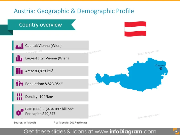
Wenn du einige Fakten über Österreich präsentieren oder einen Überblick über das Land geben möchtest, bevor du zu einem spezifischeren Thema übergehst, kannst du diese Vorlage als leicht verständliche demografische Übersichtsvorlage nutzen. Sie beinhaltet die Karte von Österreich und 6 Reihen mit Symbolen, um einige Informationen über die Hauptstadt, die größte Stadt, das Landesgebiet, die Bevölkerung, die Bevölkerungsdichte und das BIP zu erklären.
Diese Folie zum geografischen und demografischen Profil von Österreich ist Teil unserer Karte von Westeuropa mit Verwaltungsterritorien (bearbeitbare Karten von Deutschland, Frankreich).




