

Your graphics add a nice touch to my presentations and I recently used them for one of my all-hands meetings. Your toolbox adds professionalism to my slides. Instead of using standard clipart.
Claude Jones, Director of Engineer, @Walmartlabs, USA

Your graphics add a nice touch to my presentations and I recently used them for one of my all-hands meetings. Your toolbox adds professionalism to my slides. Instead of using standard clipart.
Claude Jones, Director of Engineer, @Walmartlabs, USA
I needed a fresh look at some of my slides. I've tried to find a way to create a paintbrush effect, to underline, accentuate, add some color and the handwritten markers were just the things. Very easy to use, easy to size, change the color. It was an affordable, perfect solution and I'm happy to recommend it.
Anonymous, US
The crisp, clean look of the graphics, and the fact that it allowed me to easily edit and change the colors to match the template was my main reason for purchasing them.
Brandie Jenkins, E-learning Developer, USA
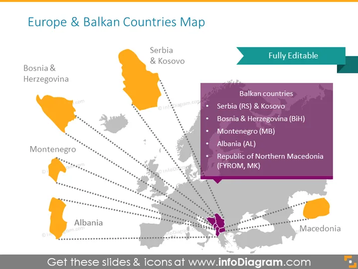
Die PowerPoint-Folie mit dem Titel "Karte von Europa und den Balkanländern" visualisiert die geografischen Standorte bestimmter Balkanländer innerhalb Europas. Die hervorgehobenen Länder, einschließlich Serbien und Kosovo, Bosnien und Herzegowina, Montenegro, Albanien und Nordmazedonien, sind in Orange und Lila gekennzeichnet. Die Folie enthält eine Seitenleiste, die die Länder zusammen mit ihren Abkürzungen auflistet: Serbien (RS) und Kosovo, Bosnien und Herzegowina (BiH), Montenegro (MB), Albanien (AL) und Republik Nordmazedonien (FYROM, MK). Dies bietet einen klaren und informativen Referenzrahmen für Zuschauer, die Informationen über die Geografie des Balkans suchen.
Die Folie ist visuell klar und organisiert und verwendet Kontrastfarben sowie einfache grafische Elemente wie gepunktete Linien und Farbhervorhebungen, um bestimmte Regionen zu kennzeichnen. Das Gesamterscheinungsbild ist professionell und geeignet für Bildungs- oder Firmenpräsentationen.



